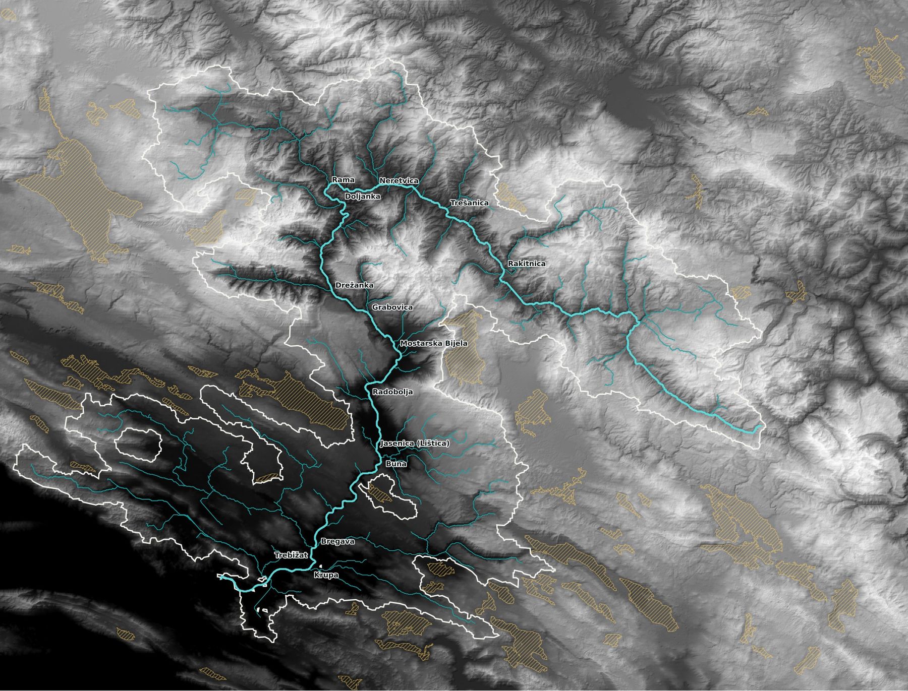
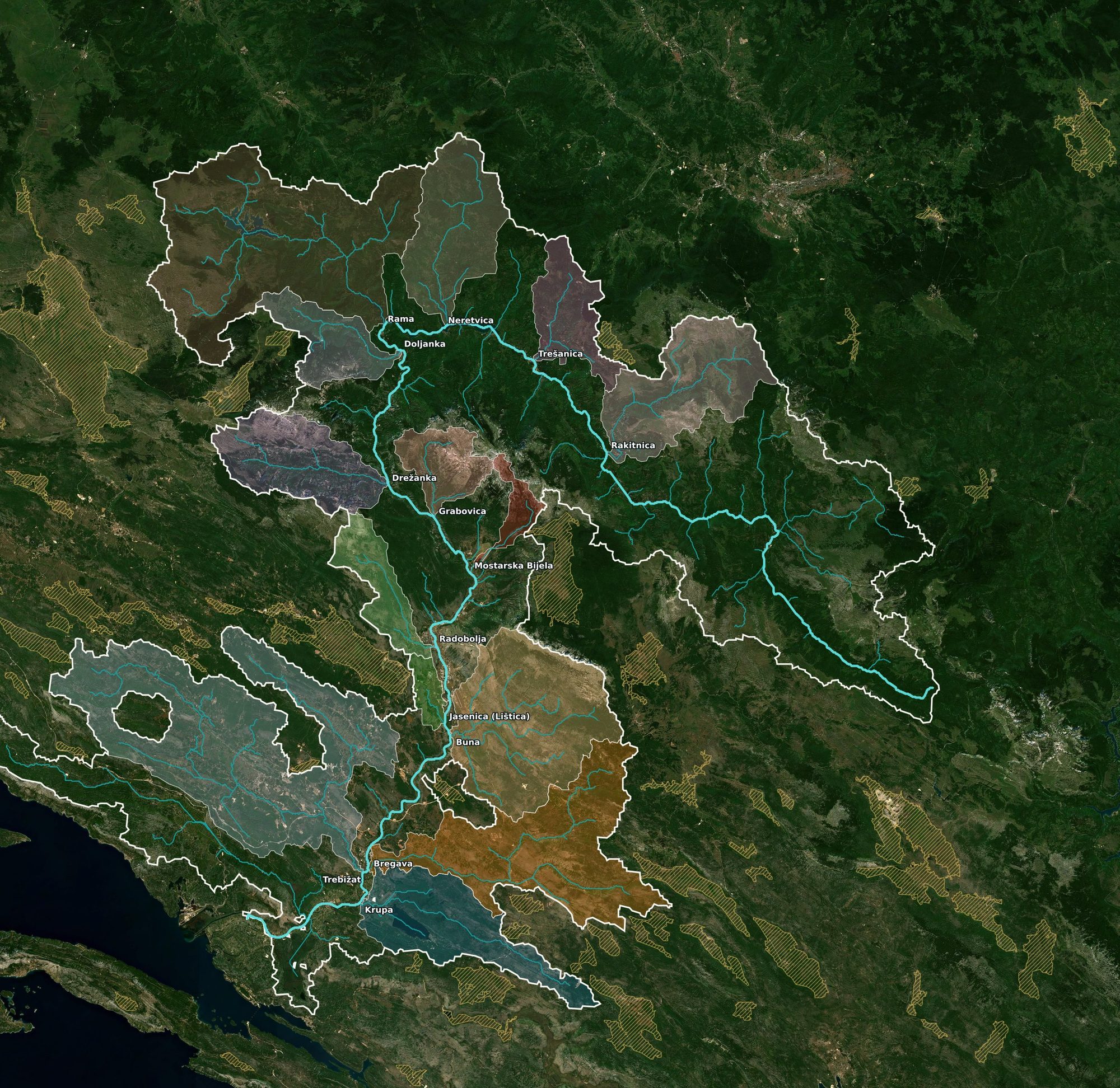
Sentinel-2 cloudless 2020 · EOX · Copernicus DEM
A Quanta piece argued that rivers everywhere are "mathematical": the length of a stream grows with its drainage area to roughly the 0.6 power. I checked the river I grew up with — every tributary, from the Rakitnica canyon to the delta — with a 90 m elevation model.
In August, Quanta Magazine asked why rivers are so mathematical. The centerpiece is a 1957 observation by the USGS hydrologist John Hack: if you measure a stream's length from its source to any point, and the area of land that drains to that point, the two are related by a power law with an oddly specific exponent. If basins simply scaled up like photocopies, the exponent would be ½; Hack found something closer to 0.6. Bigger basins are longer and skinnier than small ones, and the pattern holds from creeks to the Mississippi. The article's explanation is energetic: networks that dissipate the least energy while draining the land end up with this shape. A second regularity, from 2017, is that in humid landscapes tributaries tend to meet at about 72°.
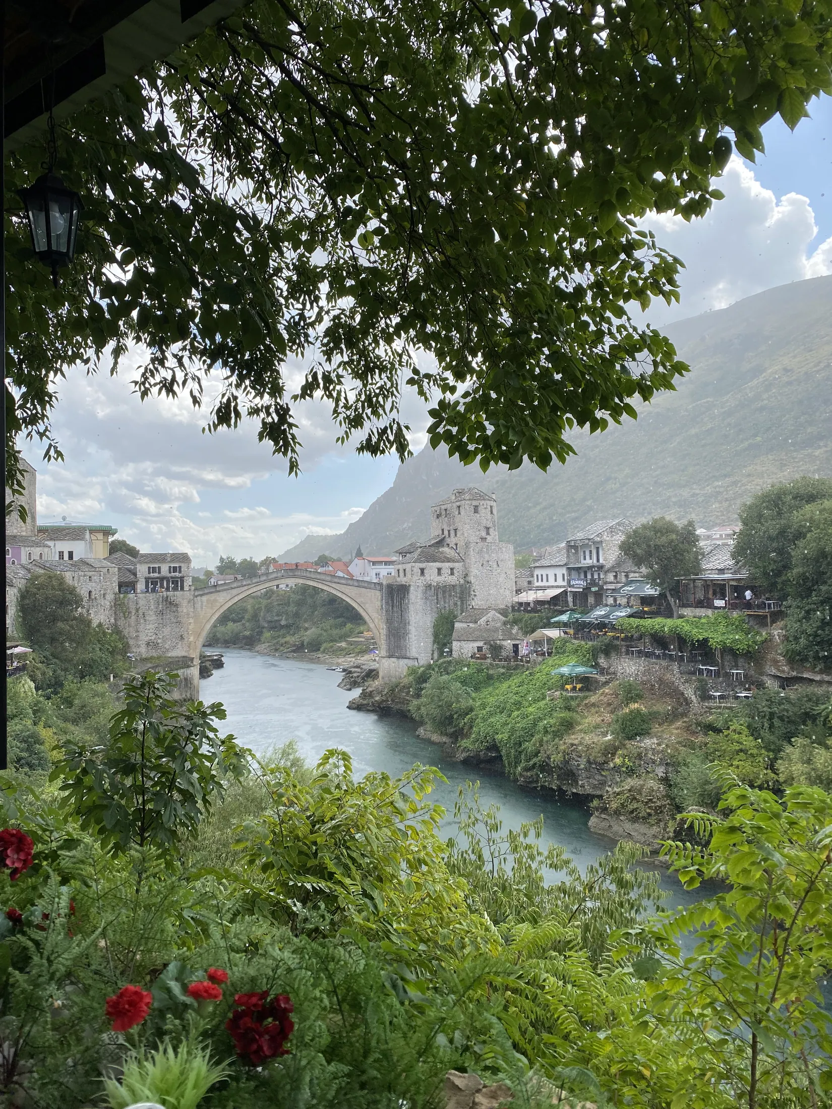
Those are universal claims, so they invite a local test. The Neretva is the river of Herzegovina, and the one I know best: Mostar's Old Bridge stands over it, and it runs about 225 km from the Zelengora mountains to the Adriatic near Ploče. It is also a difficult river to test, because most of its basin is karst: limestone country where whole rivers vanish into sinkholes and reappear as springs tens of kilometres away. That turns out to be the interesting part.
Rivers have a way of following you. Natalie spent her adolescence on the Blanco River in the Texas Hill Country, and it is the same river I spent the last seven years beside, and the one I took my older son kayaking on. The Blanco is limestone country too, a spring-fed river that runs dry in stretches and floods without warning, so when I read the Quanta piece it was hard not to wonder whether the rules that shape a river in Herzegovina are the same ones at work in Texas.
L is the length of the longest stream above a point (km), A the area draining to it (km²). Hack fit h ≈ 0.6 with C ≈ 1.4 in miles and square miles, which is C ≈ 1.27 in kilometres. Pure self-similarity would give h = 0.5.
The quickest test uses the whole river. Its length is settled: 225 km on the map and 229 km along the elevation model's valley line down to the head of the delta. Its area is a matter of definition. Depending on who you ask, the Neretva drains anywhere between about 5,400 and 11,800 km², and the disagreement is entirely about karst.
So the headline answer is yes, and the fit is almost suspiciously good, provided you count only the land whose rivers actually reach the Neretva on the surface. Add the karst fields, the flat-floored basins whose rivers sink underground, and the river is far "too short" for its area. That follows directly from the law itself: Hack's law describes networks carved by surface flow, and a karst field's water reaches the Neretva through the rock, leaving the surface untouched. The law only ever promised to describe the channels it can see.
But a single river only tests the constant. To test the exponent you need many basins of many sizes, so I built the whole network.
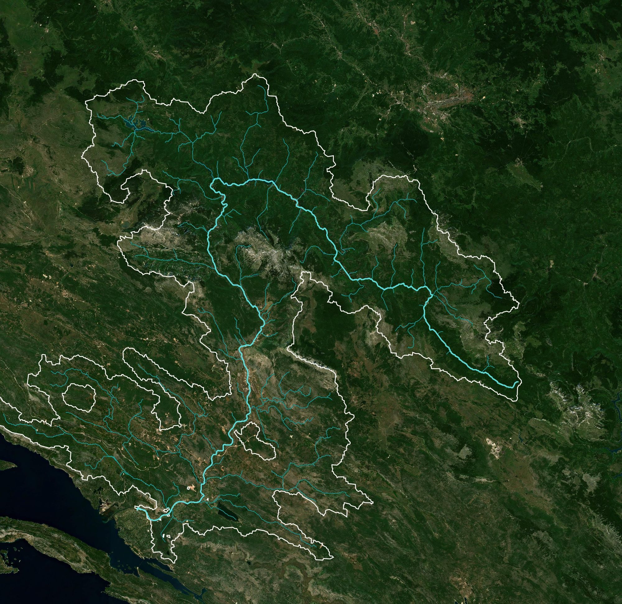
I took the 90 m Copernicus elevation model, routed water downhill across every cell, and marked the deep closed depressions as sinks. That yields a drainage network, and for each of the 2,738 places where two streams of at least 1 km² meet, it yields two sub-basins: the area feeding each branch, and the longest path water travels through it. Those pairs are the data. Hack's law says they fall on a straight line in log–log space with slope h.
The points make a clean band: R² is above 0.95 at every threshold, so the Neretva is certainly a power law. The slope is the question, and it depends on the smallest basins you allow into the fit. Using everything down to 1 km², the exponent is 0.52. Requiring at least 50 km², where a 90 m grid can no longer shave length off the headwaters, it rises to about 0.56 and stabilises. Bootstrap intervals are tight, roughly ±0.01, so the difference between 0.52 and 0.56 is real and the difference between 0.56 and 0.6 is small but also real.
Two checks push in opposite directions. A coarser dataset, the 500 m HydroRIVERS network, gives 0.58 to 0.67 on the same river depending on threshold, with a bias toward higher values because it truncates small streams even more. And fitting the tributaries alone, without the nested points along the main stem that are not independent of one another, gives 0.53. The honest summary is that the Neretva's exponent sits between 0.53 and 0.57: clearly above the self-similar ½, a little below Hack's 0.6, and squarely inside the 0.5–0.6 range that later surveys of hundreds of basins have reported. Hack's own number came from a handful of Appalachian streams, and for once in its history the Neretva behaves.
The chart's outliers are worth naming. Below are the fourteen tributaries I could identify with confidence, with the length Hack's law would give them from the fitted exponent and constant. A ratio above 1 means the river is longer than its area "deserves": a thin, elongated basin, usually a canyon following a fault or a fold. Below 1 means a compact, round basin.
| Tributary | Enters at | Area km² | Length km | Hack length | Ratio | Shape |
|---|
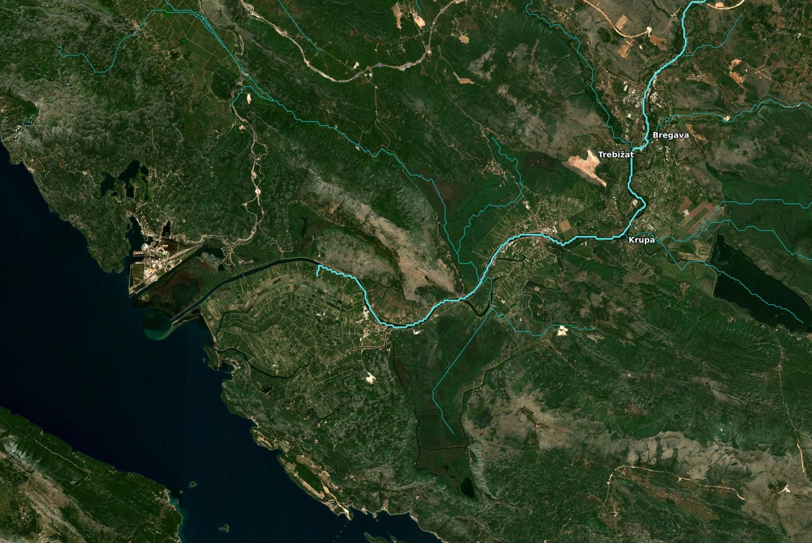
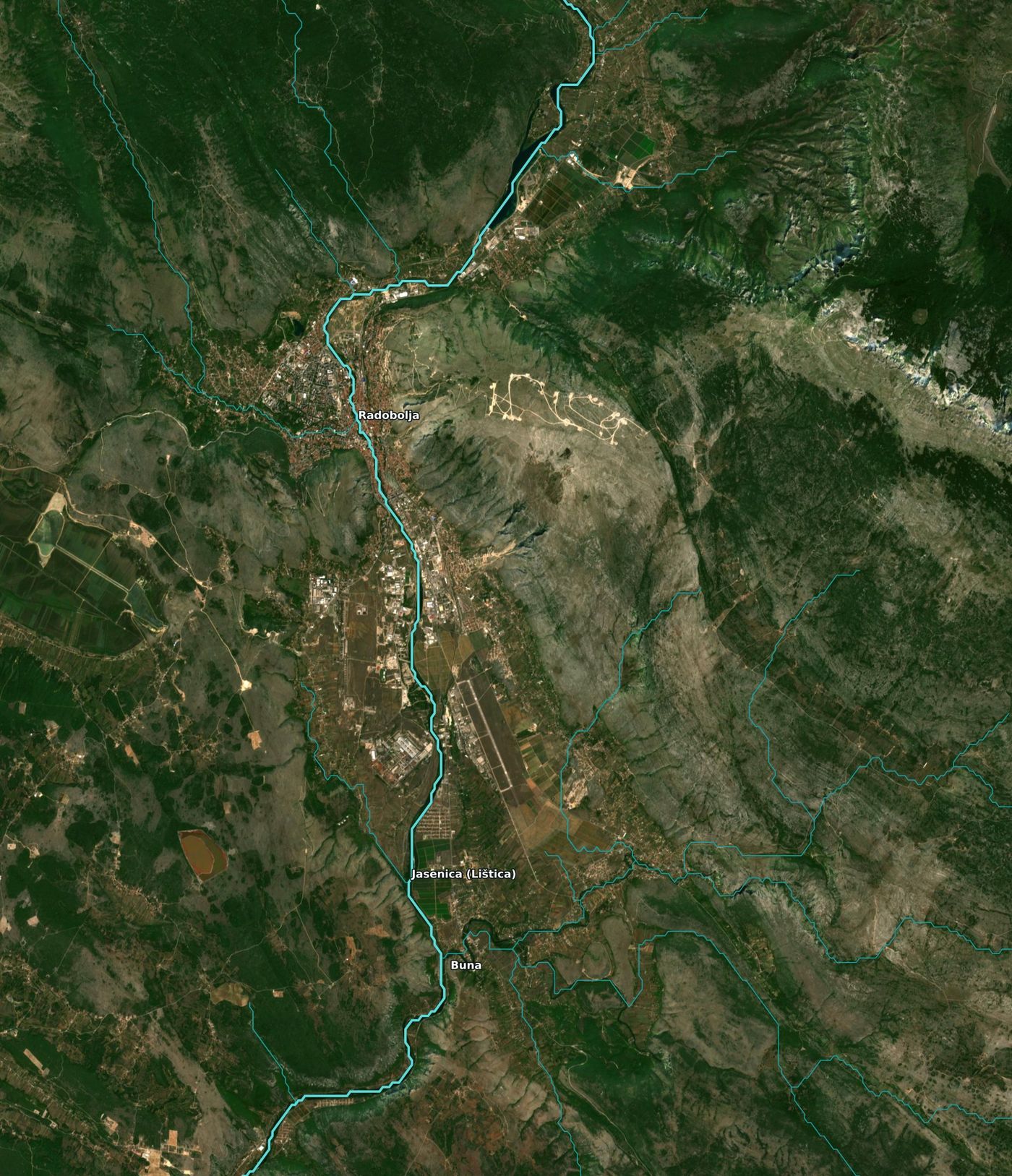
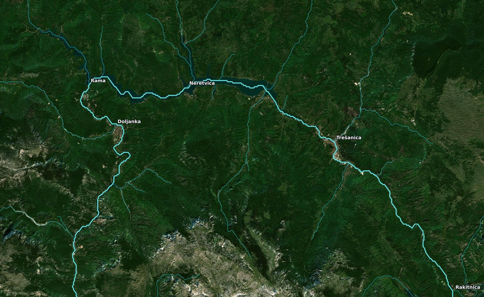
The Rama, the biggest tributary at 521 km², lands almost exactly on the line, and so do the Rakitnica, Neretvica, Trešanica and Drežanka, the canyon rivers of the upper basin. Mostar's Radobolja and Bijela run long for their size: both drain narrow strips of the Velež and Čabulja slopes. The three karst rivers of the lower basin, the Trebižat, Bregava and Krupa, all run long: their surface valleys are thin because most of their catchment reaches them through springs, which leave the valley narrow. The Buna, the most famous of them all with its spring at Blagaj, is the shortest river for its area in the table, and that is the karst again. The Buna's water is collected underground from the Nevesinje karst field far to the east; on the surface it is a nine-kilometre river with a 319 km² catchment it never had to carve.
The second regularity in the Quanta piece comes from a 2017 study of nearly a million junctions across the United States: in humid climates, where groundwater seepage shapes valley heads, tributaries join at a mean angle of about 72°, and in arid landscapes the angle is narrower. I measured the angle between the two incoming channels over their last kilometre at every junction where both branches drain at least 5 km².
The Neretva's junctions average 79° with a median of 77°, a few degrees wider than the humid prediction but well within its spread; the standard deviation here is 34°, and the original study's was similar. A 90 m grid also nudges angles toward the eight compass directions the flow-routing algorithm allows, which tends to widen them. The match is in the shape more than in the exact number: a broad hump centred in the 70s and 80s, well away from the 90° of a rectangular street grid and from the sharp 30° confluences of a braided gravel river.
Drag and zoom. The white outline is the surface basin; the hatched yellow shapes are the closed karst fields treated as sinks, which is where the Trebišnjica, the Lištica in Mostarsko blato, the Gacko and Nevesinje fields, and the Imotski field's water leaves the surface. Hover a tributary catchment to see its numbers.


For a karst river, "basin area" is above all a modelling choice. The Neretva's official figure counts the Trebišnjica, a river that flows through Trebinje, sinks in the Popovo karst field, and reappears both at the Ombla spring near Dubrovnik and in the springs that feed the Neretva's own tributaries. Dye traces prove the connection. Hack's law, though, is a statement about the geometry of channels that water cut into the surface, and by that standard the Neretva's basin is about 5,400 km² and its length is exactly what the law predicts.
That reframes the question the Quanta article raises. If river networks are optimal in the sense of minimising the energy spent moving water downhill, the Neretva's surface network is optimal for the water it actually moves on the surface. The rest of the water took a different, invisible optimisation through the limestone, and left no channel behind for Hack to measure.
Terrain: Copernicus DEM GLO-90 tiles N42–N43, E17–E18. Closed depressions were filled by morphological reconstruction; those deeper than 8 m, larger than about 2.4 km², floored above 100 m elevation and not on the Neretva's own course were treated as sinks (48 of them, mostly karst fields). D8 flow directions from pysheds; upstream area and longest flow path by a topological pass over 2.9 million cells. Hack's law fitted by ordinary least squares in log–log space on every branch entering a junction; 500-sample bootstrap intervals. Junction angles from the bearing of each branch over its last 1 km. Cross-checked against HydroRIVERS v1.0 (15 arc-second) and HydroBASINS level 12, which give a 5,949 km² surface basin and a 221 km main stem. Imagery is the Sentinel-2 cloudless 2020 mosaic served by EOX, licensed CC BY-NC-SA 4.0, fine for a personal blog, with commercial use excluded.